Highway map of Alberta
Search for more maps.
Below is a large map of Alberta showing main cities and highways. Use it to quickly find your way around the province.
But first of all...
Where is Alberta?
It lies on the left side of your Canada map. One province removed from the west coast. The only province to the west is British Columbia.
Alberta covers a large area; the distance from the north to south extreme is 11° latitude, which works out to about 1200 km (750 miles). At its widest point through, through Edmonton, it is just over 650 km. This contributes to a total area of over 660 thousand square km (255,500 sq miles). The population is nearly 5 million.
It touches the US - Canadian border on the south, bordering along the northern edge of Montana, and to our north is the great Northwest Territories (NWT). Saskatchewan lies on the east.
Here is the map, focussing on Alberta.

This map displays the seven largest independent cities of Alberta as black disks:
- Calgary
- Edmonton (the Capital city)
- Lethbridge
- Medicine Hat
- Red Deer
- Grande Prairie
- Fort McMurray
The red lines on the map show you many of the primary highways, the lowest numbered ones from 1 to 17 and the major two-digit numbered roads.
For example Alberta highway 21, 22 and 41. Highway 63 connects Fort McMurray with the rest of the world, while 35 does the same for High Level and the NWT. The yellow highlighted thoroughfares through this Alberta map include:
- The Trans-Canada Highway, which runs from the Maritimes westward through Alberta (Medicine Hat and Calgary) and onwards to the British Columbia coast.
- The Canamex Highway, the international corridor which runs from Mexico northward through the western US and Alberta into Lethbridge, and through Grande Prairie into BC. In Alberta, we call our central stretch the Queen Elizabeth II, or QE2 for short. It's the portion that connects Calgary and Edmonton.
- The Yellowhead Highway, Hwy 16, which runs from Manitoba through Edmonton and westwards to BC.
What is not Shown?
Both major cities benefit from ring roads, which improve transportation and boost economic growth. Here are a few facts about them.
 By AceYYC, OpenStreetMap contributors - Own work, CC BY-SA 3.0, Link
Calgary's Stoney Trail Ring Road, also known as Highway 201, is a 101-kilometer freeway that circles the city. Calgary's ring road idea dates back to the 1960s, with planning and land acquisition beginning in the 1970s. Initially constructed in the 1990s, the road was completed in stages over several decades, and the last leg, the west leg, opened in 2023.
Its features:
- 101 kilometers (63 miles) long.
- Connects with major routes such as Macleod Trail, Glenmore Trail, and Deerfoot Trail.
- Near Beddington Trail, it carries nearly 70,000 vehicles a day.
- CANAMEX Corridor links Calgary to Edmonton and the United States and serves as a bypass for congested routes.
- Nakoda First Nation inspired the name, reflecting the region's Indigenous heritage.

Anthony Henday Drive, or Highway 216, is a 78-kilometer freeway that encircles Edmonton. In the 1970s, land acquisition and design work began. In 2016, the entire ring road was completed, making it the first fully completed ring road around a major Canadian city.
This is what it has:
- 78 kilometers (48 miles) long.
- Intersections include Calgary Trail, Whitemud Drive, and Yellowhead Trail.
- With more than 105,000 vehicles per day at its busiest point, it is one of the busiest highways in Western Canada.
- It acts as a commuter and truck bypass route, reducing congestion and improving traffic flow in Edmonton.
- The road was named after Anthony Henday, the first European to visit Edmonton.
An interactive highway map of Alberta
Need more details than this one above?
OpenStreetMap is one of the best-kept secrets of interactive online maps. A community of mappers created this free, collaborative map. It's a great choice for these reasons:
It is intuitive and easy to navigate, making it accessible to beginners.
- Customizable: Add new locations or edit existing ones.
- A privacy-focused mapping service: OpenStreetMap doesn't track your location or collect personal information
Want to try an Alberta Open street map?
Find Calgary or Alberta with the search bar on the site. It's even easier if you use this link, where you automatically see the whole province from a high level and then can move about as you wish:
- Use your mouse scroll wheel or + and - buttons to zoom in or out.
- Drag and drop to move.
Bonus: Make an account to add points of interest and special routes to the map.
What kind of driving experience did you have?
Have a few tips and instructions for people who are using maps. Figuring out how to find something can be daunting at times and any added info can be a treasure.
If you got it, maybe someone else needs it. Please enter a paragraph or two to show how you did it, how you found it, how you got there.
Some parts of Calgary can be quite confusing and any help will be welcomed.
Thank you.
Here are some examples
Check below to see contributions from other visitors to this page...
We had fun - Elizabeth 
Western Honeymoon
My husband and I flew to Calgary from Toronto for our honeymoon on September 10th. We arrived at the airport and rented a car and …
Never been to Alberta and it was the first time looking at it on a map. 
I am familiar with Calgary and Edmonton because of professional hockey. As an Angel fan in baseball, Edmonton was their triple A affiliate and I was …
My Thoughts
Well, I have never been to Alberta yet, but from what I know about the province the map seems pretty accurate and easy to read.
I'd love to do a car …
I think I acquired a very basic familiarity with the main geographical features of Alberta.
I know very little about Canada, but this was a good starter kit for the basic layout of Alberta. I'll probably most remember that it borders Montana and …
petar point of view
Hy, I am Petar and i know lot of Canada. I have couple of friends living there and by the pictures I can tell that Canada is very nice country. Much nicer …
Drove through Alberta on the way to Alaska Not rated yet
Passed through Yellowhead Highway through Edmonton and Grand Prairie. The city was overwhelming at times as far as exits for highway-stay alert. People …
Attractions in calgary alberta Not rated yet
i've been to Alberta.. and i sure could have used a map like that. next time i'll visit this site before driving to Calgary again.
Barry's Response …
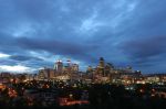
Calgary map of Alberta

The larger city near the south end of Alberta is Calgary. It's the largest urban centre in the entire Province, and all the prairies. Find detailed
street maps of the city here, and you can also check this unique
downtown Calgary walking map.
Search this site for more information now:
...or Go back from this Map of Alberta webpage to the Alberta Canada Weather page now.
Recent Articles
-
Calgary Canada Weather - You shall Never Find a Dull Moment
Mar 09, 25 01:59 PM
 Forecasts for Calgary Canada weather. Compare forecasts from Environment Canada, the Weather Network and others.
 -
Auto Trader Calgary | Do YOU Need the Perfect Car?
Mar 02, 25 09:49 PM
 Life in Calgary. Find the deal you need with "Auto Trader Calgary" or by visiting the lots on this page.
 -
oneway streets downtown
Feb 24, 25 12:20 AM
 Hard to find a map of downtown Calgary that shows the oneway streets Barry's Response - Here is a crude reproduction of an olde-style Google map for the